NYC On Foot

It's been awhile since I've been on here-What can I say, I've been a bit busy lately. Most of you may or may not know that I've been routinely going down to New York City to shoot Punk and Hardcore shows-and that's been the largest part of my photographic output over the last couple of years. But, shows don't run 24-7, and I don't sleep the whole time between any given two shows; so that leaves me with time on my hands, and I really don't dig spending that time sitting around looking at TV in the hostel that I usually stay in.

New York City is a fascinating place. I don't mean just the usual touristy stuff either. Every corner you turn, you can find something interesting and unique. It's almost like a state unto itself: particularly as far as the roads are concerned. The signage is much different than the rest of the state, and the iconic double-guyed traffic lights aren't found anywhere else. In fact, new traffic lights follow the same design used for years. There are street lamps about that have been around since nearly the turn of the last century. And there are bridges.

One of the things about NYC is that it's reasonably pedestrian friendly, and despite cutbacks, it still has one of the best transit systems going. It makes it easier to get up close and personal with the city. Over the New Year's holiday, I had a hankering to go to Rockaway Beach, to see at least a part of the Rockaway Freeway. No problem, I hopped on the Subway and away I went.
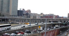
I spent a good couple of hours walking around the area, taking pictures. I was particularly interested in the elevated railway over the 'freeway' that carried the 'A' train.


Again, last weekend found me with a nice day and some spare time, so I decided it would be a nice day to take a stroll over the Brooklyn Bridge. It's kind of an odd experience, because auto traffic flies across the bridge as if it were a freeway, yet the pedestrian deck is kind of like a linear park, even a bit festive with people selling T-shirts and souvenirs. Amazingly enough, there was hardly any graffiti-except on some temporary construction structures. Even the taggers respect the bridge.

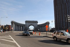
Since the Brooklyn foot of the Manhattan Bridge was only a few blocks away, I decided to cross back into Manhattan that way. The Manhattan Bridge is not as easily photographed from it's pedestrian deck, though you get some decent views from it, just the same; and there's a nifty portal at the Manhattan foot of the bridge. It lets out in Chinatown at Bowery and Canal-which is not too far from yet another bridge-the Williamsburg which I've crossed over on a couple of times.


Next on my list is the Queensboro bridge-which should yield some interesting pictures. The 7 train emerges above ground at the bridge plaza, so I've had a chance to at least partially reconnoiter the area.

Comments

Larry G said…
How do you "navigate" NYC on foot?

Popular posts from this blog

Paper Highways: The Unbuilt New Orleans Bypass (Proposed I-410)

  There are many examples around the United States of proposed freeway corridors in urban areas that never saw the light of day for one reason or another. They all fall somewhere in between the little-known and the infamous and from the mundane to the spectacular. One of the more obscure and interesting examples of such a project is the short-lived idea to construct a southern beltway for the New Orleans metropolitan area in the 1960s and 70s. Greater New Orleans and its surrounding area grew rapidly in the years after World War II, as suburban sprawl encroached on the historically rural downriver parishes around the city. In response to the development of the region’s Westbank and the emergence of communities in St. Charles and St. John the Baptist Parishes as viable suburban communities during this period, regional planners began to consider concepts for new infrastructure projects to serve this growing population.  The idea for a circular freeway around the southern perimeter of t

Hernando de Soto Bridge (Memphis, TN)

The newest of the bridges that span the lower Mississippi River at Memphis, the Hernando de Soto Bridge was completed in 1973 and carries Interstate 40 between downtown Memphis and West Memphis, AR. The bridge’s signature M-shaped superstructure makes it an instantly recognizable landmark in the city and one of the most visually unique bridges on the Mississippi River. As early as 1953, Memphis city planners recommended the construction of a second highway bridge across the Mississippi River to connect the city with West Memphis, AR. The Memphis & Arkansas Bridge had been completed only four years earlier a couple miles downriver from downtown, however it was expected that long-term growth in the metro area would warrant the construction of an additional bridge, the fourth crossing of the Mississippi River to be built at Memphis, in the not-too-distant future. Unlike the previous three Mississippi River bridges to be built the city, the location chosen for this bridge was about two

Huey P. Long Bridge (New Orleans, LA)

Located on the lower Mississippi River a few miles west of New Orleans, the Huey P. Long Bridge is an enormous steel truss bridge that carries both road and rail traffic on an old-time structure that is a fascinating example of a bridge that has evolved in recent years to meet the traffic and safety demands of modern times. While officially located in suburban Jefferson Parish near the unincorporated community of Bridge City, this bridge’s location is most often associated with New Orleans, given that it’s the largest and most recognizable incorporated population center in the nearby vicinity. For this reason, this blog article considers the bridge’s location to be in New Orleans, even though this isn’t 100% geographically correct. Completed in 1935 as the first bridge across the Mississippi River in Louisiana and the first to be built in the New Orleans area, this bridge is one of two bridges on the Mississippi named for Huey P. Long, a Louisiana politician who served as the 40th Gove