
It's been nearly 20 years since we've seen this number on a North Carolina highway.
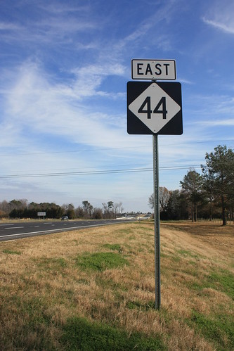
The first leg of the 20 mile Goldsboro Bypass opened to traffic Friday Morning - with no fanfare at all. The 3.9 miles of freeway carries the designation of NC 44. This is the second incarnation of NC 44 - the first lasted from the 1930 until 1994 in the northeastern part of the state. In 1994, NC 44 was replaced by extensions to NC 33 and 111.
This version of NC 44 won't last more than a decade either. When the entire bypass is complete - most likely in 2016 - US 70 will move onto the new bypass. This might me a first, as I don't know of any other new highway in North Carolina receiving a temporary number - only to be redesignated another route number when the highway is completed.
For the entire photo set on flickr - head here.
NC 44 begins at Interstate 795.
I-795 North and South will have flyover ramps connecting to the bypass - while NC 44 will have conventional ramps to the Interstate.
The milemarkers and exit numbers for NC 44 follow US 70's mileage. Hey, it's one less thing to change when 70 moves onto the bypass.
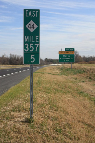
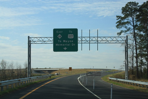
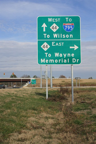
This is looking east from Wayne Memorial Drive. Construction to continue the bypass east towards US 13 and then join back with the current US 70 near LaGrange should be gin late in 2012 or early 2013.

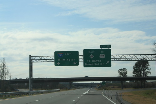
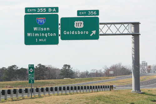
Here's NC 44 west at US 117.
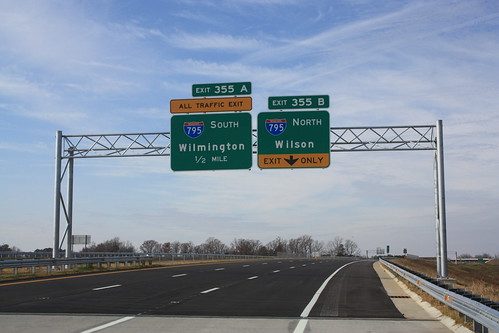
And finally, the current west end of NC 44 at I-795.
Finally, on US 117 at NC 44 a few different type of signs that haven't been common in NC. First, this sign at the interchange. I really like this and hope more interchanges at the state will use these.
There are also - a first I think for the state - California style 'Freeway Entrance' signs at each ramp on US 117. I didn't notice this until driving home Friday night and it was dark so I am going to try and get a photo of it next week.
The first leg of the 20 mile Goldsboro Bypass opened to traffic Friday Morning - with no fanfare at all. The 3.9 miles of freeway carries the designation of NC 44. This is the second incarnation of NC 44 - the first lasted from the 1930 until 1994 in the northeastern part of the state. In 1994, NC 44 was replaced by extensions to NC 33 and 111.
This version of NC 44 won't last more than a decade either. When the entire bypass is complete - most likely in 2016 - US 70 will move onto the new bypass. This might me a first, as I don't know of any other new highway in North Carolina receiving a temporary number - only to be redesignated another route number when the highway is completed.
For the entire photo set on flickr - head here.
NC 44 begins at Interstate 795.
I-795 North and South will have flyover ramps connecting to the bypass - while NC 44 will have conventional ramps to the Interstate.
The milemarkers and exit numbers for NC 44 follow US 70's mileage. Hey, it's one less thing to change when 70 moves onto the bypass.
This is looking east from Wayne Memorial Drive. Construction to continue the bypass east towards US 13 and then join back with the current US 70 near LaGrange should be gin late in 2012 or early 2013.
Here's NC 44 west at US 117.
And finally, the current west end of NC 44 at I-795.
Finally, on US 117 at NC 44 a few different type of signs that haven't been common in NC. First, this sign at the interchange. I really like this and hope more interchanges at the state will use these.
There are also - a first I think for the state - California style 'Freeway Entrance' signs at each ramp on US 117. I didn't notice this until driving home Friday night and it was dark so I am going to try and get a photo of it next week.
Comments
Perhaps, like the signage at the US 117 ramps, it is a new policy that will occur again at future incomplete, yet open, bypass highways as well. Guess time will tell.