
Back in July of 2016 I took Mineral King Road east from California State Route 198 to Mineral King Valley within the Sierra Nevada Mountains of Sequoia National Park. This June I revisited Mineral King Valley and made my way up to the White Chief Mine.

Mineral King Road has an average grade of 5.1% but has several stretches between 15-20% in places. Pjammycycling has a detailed breakdown on the grade levels over the entirety of Mineral King Road.
Pjammycycling on Mineral King Road
Part 1; the history of Mineral King and Mineral King Road
What is now Mineral King was first settled by the a Yokut tribal subgroup known as the Wukchumni approximately 3,000 years ago. The Wukchummi had permanent settlements on the Kaweah River near the Terminus Dam and modern day Orange Cove. The Wukchumni had numerous summer settlements on the East Fork Kaweah River watershed near the modern locales of; Atwell Mills, Silver City, and even Mineral King Valley. White Chief Valley is a documented hunting ground of the Wukchumni.
Mineral King History of a Living Community; The Beginnings
The first substantiated evidence of someone of European descent having passed through Mineral King Valley was during 1847. A mountain man known as the John Moss had descended to a Wukchumni village via the East Fork Kaweah River while crossing the Sierra Nevada Mountains. The path of travel Moss over the Sierra Nevada Mountains took was directly through Mineral King Valley.
During 1860 Hale Tharp and John Swanson explored the watershed of the East Fork Kaweah River in addition to the South Fork Kaweah River. During 1863 Harry O'Farrell entered Mineral King via Farewell Gap on a hunting expedition. O'Farrell noted a strong likelihood of mineral wealth and returned in 1864 to prospect. O'Farrell set up his camp at the confluence of Monarch Creek and the East Fork Kaweah River within Mineral King Valley. O'Farrell's camp was the first permanent settlement of Mineral King Valley since the Wukchumni abandoned it.
Through the 1860s additional prospectors arrived in Mineral King Valley. In 1870 John Lovelace and his family built a stock trail up to what was known as Milk Ranch on the East Fork Kaweah River. The Lovelace extended their trail all the way up to Mineral King Valley and the prospector camp sites. In 1871 the stock trail was greatly improved and by 1872 the Lovelace family was driving cattle into Mineral King Valley.
Mineral King History of a Living Community; The Early Explorers
The Milk Ranch Trail split far north from much of modern Mineral King Road by way of Oriole Lake. From Oriole Lake the Milk Ranch Trail emerged to the location of Atwell Mills via Redwood Creek. An 1883 Surveyor General Map hosted on mineralking.org shows the route of the Milk Ranch Trail.
Mineral King Road Corridor; Milk Ranch and Oriole Lake
During August of 1872 a large silver claim was struck on the East Fork Kaweah River in White Chief Valley by a prospecting company led by John Crabtree. By fall of 1872 merchants in Visalia raised $3,000 dollars to extend the County Road from Three Rivers to Mineral King Valley. The first community near Mineral King known as "Silver City" was built six miles below Mineral King Valley during 1872 before a roadway was built. By the fall of 1873 there was over sixty mining claims filed in the vicinity of Mineral King Valley. By 1875 the following communities were documented to have sprung up around the Mineral King mining claims; Silver City, The Gate/Barton's Camp, Harry's Bend, Sunny Point, Beulah, Ford's Camp, White Chief Camp, and Harmonville. By 1879 there was a reported approximate population of 3,000 people living around the Mineral King mining claims.
Mineral King History; The Boom Days
The first real road to Mineral King was partially constructed by the Visalia & Inyo Wagon Company beginning in 1873. The new road to Mineral King was built from Hammond (now part of Three Rivers on CA 198) over the formation known as Red Hill. Construction of the new road from Red Hill continued during 1874 and was built largely on the south side of the East Fork Kaweah River Canyon. The new road crossed the East Fork Kaweah River somewhere between Lake Canyon and Lookout Point to the existing Milk Ranch Trail. Although the East Fork Kaweah River road was the favored route to Mineral King two other trails were used during the 1873-1875 Mineral King mining boom. One trail followed the South Fork Kaweah River to Hockett Meadow and onward to Mineral King via Tar Gap. The second trail followed the North Fork Tule River and Little Kern River to Farewell Gap.
During the second mining boom in Mineral King the Empire Mine was bought out by Tulare County rancher and politician Tom Fowler. Fowler had purchased a stamp mill out of Grass Valley but had no real way of transporting it over the existing road to Mineral King. This led to the formation of the Mineral King Wagon & Toll Road Company during 1879. During March of 1879 construction of the new Mineral King Road had begun.
The new Mineral King Road diverged from the previous road at Red Hill where it crossed to the north bank of the East Kaweah River Canyon. The new Mineral King Road followed 25-35% grades over River Hill to the community of Oak Grove. Construction of the second Mineral King Road east from Oak Grove to Mineral King was completed by August 1879 and essentially is the same route used by the modern highway. The River Hill Grade is described in historic records as hellish and would often tire out horses hauling freight to Mineral King. The River Hill Grade was intended to be a temporary route that was built to facilitate wagon travel as quickly as possible to Mineral King.
Mineral King Road Corridor; River Hill Grade
The River Hill Grade of Mineral King Road as seen on mineralking.org.

The River Hill Grade was largely blasted out of rock and mostly lacked an earthen surface. The River Hill Grade essentially diverged from a toll house that was located at Red Hill at Mountain Road 375 Post Mile 1.0 east to approximately Mountain Road 375 Post Mile 6.5 near the 1923 Kaweah River Bridge. A trace of the River Hill Grade can be seen on the north bank of the East Fork Kaweah River west of the 1923 Kaweah River Bridge on Google Maps images.

The second Mineral King Road was managed by the Mineral King Wagon & Toll Road Company until it was deeded to Tulare County during 1884. Tulare County lacked the funds to properly maintain Mineral King Road during the latter years of the 19th Century. Maintenance of Mineral King Road during the 1880s was conducted by Atwell Mills and the Mineral King Resort. During September 1890 the Redwood Sequoia Groves on Mineral King Road were annexed into the newly formed Sequoia National Park. The U.S. Army troops stationed at Sequoia National Park maintained the upper portions of Mineral King Road during the 1890s. Mineral King Road can be seen on the 1892 Thompson Township and Range Maps of Tulare County.
T.16-17S R.28-29E shows Mineral King Road crossing over the East Fork Kaweah River at Red Hill and ascending eastward over the River Hill Grade.

T.16-17S R.30-31E shows the remainder of Mineral King Road ascending eastward to Mineral King itself.

By 1898 the Mount Whitney Power Company had constructed it's flume on the southern flanks of the East Fork Kaweah River Canyon opposite Mineral King Road. By 1910 the automobile era had arrived in California and the State had just passed the 1909 First State Highway Bond Act. Atwell's Mill, the Oriole Lodge, and Mineral King Resort all desired a better version of Mineral King Road to facilitate automotive recreational travel. The Mount Whitney Power Company also desired automotive access via Mineral King Road to more easily maintain it's flume.
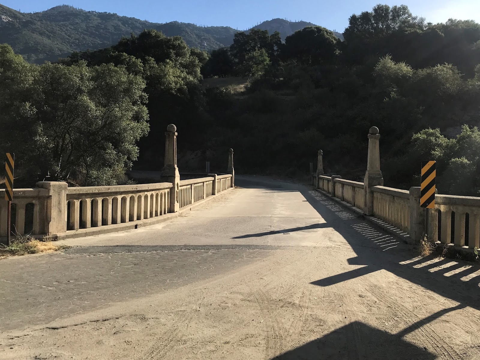
During June 1910 a petition was filed with the Tulare County Board of Supervisors to build a new bypass route of the River Hill Grade. A bond was issued for a road survey which ultimately led to a recommendation that a new bypass should originate from Red Hill and follow the south bank of the East Fork Kaweah River Canyon 5.25 miles to Cain's Flat. Construction of what was known as County Road 981/Visalia-Mineral King Cut-Off began during 1911 and would be completed during summer of 1913. The new realigned Mineral King Road crossed the East Fork Kaweah River at Cain's Flat via a wooden road bridge which was located next to the present site of 1923 Kaweah River Bridge. Photos of the 1913 Kaweah River Bridge can be seen on mineralking.org:
Mineral King Road Corridor; The New Road
Automotive travel began to arrive in Mineral King shortly after completion of the new alignment of Mineral King Road. The old River Hill Grade remained in use until it was abandoned during 1915. The current Mineral King Road between Hammond and Mineral King can be seen on the 1917 California State Automobile Association Map of California.

Until 1903 Mineral King Road was the primary access point for travelers to Sequoia National Park. In 1903 the Colony Mill Road was extended by 8 miles into the Giant Forest by the U.S. Army to facilitate wagon travel into Sequoia National Park. In 1905 Sequoia National Park ceded some of the water rights of the Kaweah River watershed to the Mount Whitney Power Company. In exchange the Mount Whitney Power Company would improve the Colony Mill Road in addition to building better roadway access to the Giant Forest. The yield of the construction by the Mount Whitney Power Company was the Middle Fork Road which later became a central feature of the alignment of the Generals Highway. The desirability of Mineral King Road as an access point to Sequoia National Park was also likely impacted when the 1906 San Francisco Earthquake level almost all the existing structures around Mineral King.
During the 1919 Third State Highway Bond Act Legislative Route 10 was extended east from Visalia to the vicinity of Hammond to facilitate automotive travel to Sequoia National Park. The Colony Mill Road ascending to the Giant Forest of Sequoia National Park from the eastern terminus of LRN 10 at Three Rivers along with Mineral King Road can be seen on a 1919 Tulare County Road Atlas.

Starting in 1921 traffic headed to the Giant Forest would make a one-way ascent on the Colony Mill Road and a one-way descent on the Middle Fork Road. From 1921 to 1926 Tulare County improved the Colony Mill Road, Middle Fork Road, and Mineral King Road for easier automotive travel. The yield of this construction by Tulare County on Mineral King Road was the 1923 Kaweah River which replaced the now 1913 Bridge. The 1923 Kaweah River Bridge (shown as the Oak Grove Bridge) can be seen in this sketch below (from this Library of Congress article).

Mineral King Road can be seen on the 1935 California Division of Highways Map of Tulare County.

During 1958 the Tulare County Board of Supervisors requested the State of California build an weather highway to Mineral King due it having a significant potential for winter sports. Subsequently Legislative Chapter 1372 of 1965 defined the new California State Route 276. The planned CA 276 first appears on the 1966 Division of Highways Map of California. As originally defined CA 276 originated at CA 198 in Three Rivers and terminated at Mineral King.

During December 1965 the Forest Service awarded a permit to the Walt Disney Corporation to submit a plan to build a ski resort in Mineral King Valley. During October 1966 Governor Edmund G. Brown announced a $3 million dollar Federal Grant towards the construction of CA 276. Governor Brown sought to apply for a $9 million dollar loan towards the construction of CA 276 The Forest Service approved the Disney Corporation's plans for a ski resort during January of 1969. The Disney Ski Resort in Mineral King was slated to open during the winter 1973 when CA 276 was anticipated to be completed.
Almost from the outset there was strong resistance to the Disney Ski Resort in Mineral King. The new route of CA 276 would have to pass through Sequoia National Park which drew heavy environmental resistance. During March of 1967 U.S. Secretary of the Interior Stewart Udall expressed concerns about CA 276 and suggested a that a monorail system would be more environmentally suitable. During May of 1972 the Disney Ski Resort plans were scaled back to a ten lift resort which included a 15 mile cog railway. The Disney cog railway was planned to follow the existing Mineral King Road and would be operated by the company at no profit. During August 1972 Governor Ronald Reagan signed Legislation which truncated the planned route of CA 276 to the boundary of Sequoia National Park near Lookout Point. The truncated planned route of CA 276 can be first seen on the 1975 Caltrans State Highway Map.

During October 1973 the Sierra Club began to contest the Disney Ski Resort in court. The crux of the argument to shutter was the Disney cog rail was that it required an environmental impact survey which would take until 1976 to complete. The Forest Service attempted to revive the Disney Ski Resort during 1977 but the company moved it's interests to the Lake Tahoe area. In 1978 Congress approved the transfer of Mineral King from Sequoia National Forest to Sequoia National Park. The additional protections provided as part of a National Park essentially blocked any future development of a ski resort. Mineral King appears now on modern National Park Service Maps as part of Sequoia National Park.

Despite being effectively blocked from any real utility the 1972 Legislative Description of CA 276 was never deleted. The planned CA 276 still appears on the 2005 Caltrans State Highway Map.

Part 2; the 2016 downhill drive on Mineral King Road
During July 2016 the sun glare was awful ascending Mineral King Road eastward I took my photo album westward heading downhill from Mineral King Valley to CA 198. Mineral King Road starts at the White Chief Mine Trailhead parking lot along the south bank of the East Fork Kaweah River. Mineral King Valley is a glacial valley much like Yosemite Valley and is 7.5 miles long by 1 mile wide. The walls of Mineral King Valley ascend as high as 11,000 feet above sea level.

Mineral King Road westbound crosses over to the north bank of the East Fork Kaweah River on a wooden bridge.


Mineral King Road during July 2016 2as flooded with deer, marmots, and likely some unseen black bears. Looking west the grade downhill on the East Fork Kaweah River Canyon was an obvious sight.


Mineral King Road is largely paved and passes through trace remains of the various mining communities that used to line the area. The roadway is narrow but generally has enough room for vehicles to pass each other easily. Between Mineral King Valley and the six miles west to Silver City the grade of Mineral King Road drops to a dirt surface covering broken asphalt.


Six miles west of Mineral King Valley the route of Mineral King Road becomes paved again entering Silver City. Silver City lies at approximately 6,900 feet above sea level and largely consists of cabin structures that were built after 1906. The 1929 Silver City Store has an older mechanical gas pump in front of the structure. Silver City apparently has no power grid which makes the community quite the throwback to a bygone era.


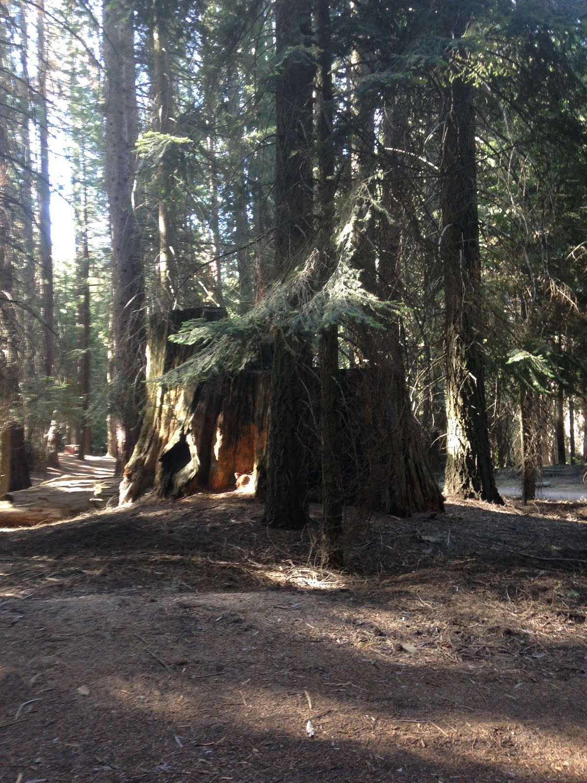
West of Silver City is Mineral King Road passes through another small dirt section and enters Atwell Mills around 6,300 feet above sea level. Atwell Mills served the Mineral King mining district during it's heyday and processed fallen Redwood Sequoias. Various Sequoia stumps line the side of Mineral King Road through Atwell Mills.


West of Atwell Mills the alignment of Mineral King Road passes through another Sequoia Grove where it emerges on the cliff face north of the East Fork Kaweah River. Between the elevations of 5,000 feet down to 2,700 feet I found myself on a massive downhill descent which apparently approached 20%. I found myself mostly using 1st or 2nd gear through this section of Mineral King Road.


At approximately 4,000 feet above sea level Mineral King Road meets a sharp curve which houses the Mineral King Entrance Station for Sequoia National Park at Lookout Point. All of Mineral King Road west of Lookout Point to CA 198 is outside the Sequoia National Park boundary.


At approximately 2,500 feet above sea level Mineral King Road descends to the East Fork Kaweah River where it crosses the 1923 Kaweah River Bridge to the south bank.


Mineral King Road west of the 1923 Kaweah River Bridge lines of the south bank of the East Fork Kaweah River Canyon to Red Hill.


At Red Hill approaching Three Rivers the terrain around Mineral King Road becomes much more indicative of the Sierra Foothills.

Mineral King Road ends at California State Route 198. The eastern terminus of CA 198 is only two miles to the east at the start of the Generals Highway.


Part 3; the 2020 return ascent on Mineral King Road
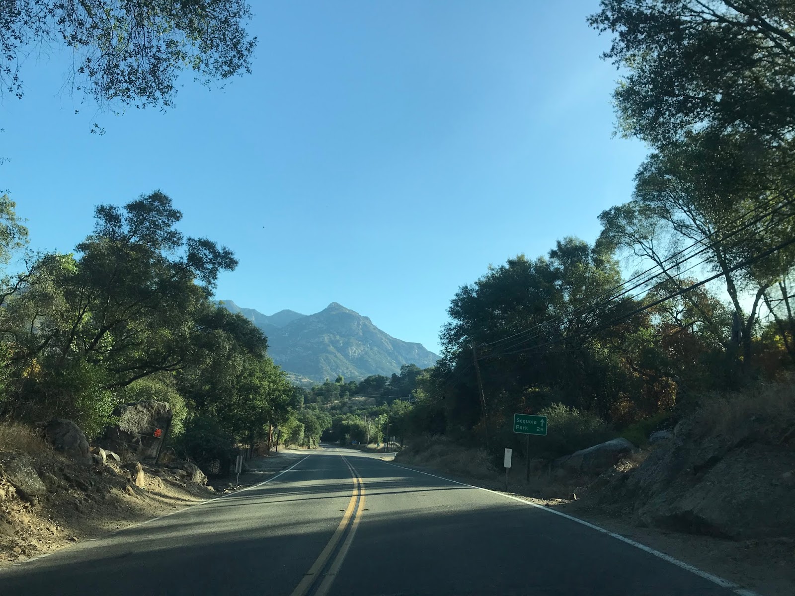
During June of 2020 the COVID-19 restrictions ended at Sequoia National Park. Given a trip to Mineral usually entails some degree of self reliance I thought it would make for a nice day trip. My end goal was to climb the White Chief Mine. CA 198 eastbound intersects Mineral King Road at approximately Post Mile TUL 42.325 in the Hammond neighborhood of Three Rivers.


Mineral King Road eastbound begins at approximately 1,400 feet above sea level. Mineral King Road traffic is advised that the Sequoia National Park boundary is located 11 miles away. The Atwell Mills Campground and Cold Spring Campground were listed as closed due to COVID-19 restrictions. Amusingly traffic on Mineral King Road is further advised that CA 198 is the primary access route to Sequoia National Park by way of the Generals Highway.


Mineral King Road quickly climbs Red Hill. At Hammond Drive a sign notifies traffic to expect 23 miles of curves...talk about an understatement.


Post Mile 1.0 on Mineral King Road is the approximate point where the River Hill Grade alignment split from the modern highway.


Mineral King Road continues to climb over Red Hill and passes by Oak Grove Drive.


Mineral King Road ascends past 2,000 feet above sea level and emerges onto the southern flank of the East Fork Kaweah River Canyon.


Mineral King Road follows the south bank of the East Fork Kaweah River Canyon. Above head the 1898 Mount Whitney Power Company Flume can be seen which merges in with Mineral King Road at Post Mile 6.5.


Mineral King Road crosses the East Fork Kaweah River at Cain's Flat via the 1923 Kaweah River Bridge. The 1913 Kaweah River Bridge would have been located just in front of the 1923 Bridge in the second photo below.


Mineral King Road climbs atop the north rim of the East Fork Kaweah River Canyon. Mineral King Road intersects the opposite end of the River Hill Grade and passes through what was the community of Oak Grove.


Mineral King Road climbs above 3,000 feet above sea level and intersects Oriole Lake Road.


Mineral King Road passes by a final parcel of private land near Lake Canyon. A small waterfall on Squirrel Creek can be observed from Mineral King Road.


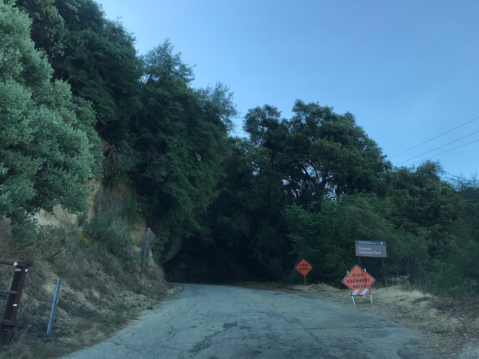
Mineral King Road enters Sequoia National Park approximately 11 miles from CA 198. The National Park boundary is marked with a cattle guard. Despite what the sign states Mineral King Road is still Post Miled as Mountain Road 375 all the way to Mineral King. Given the massive grade of Mineral King Road the Sequoia National Park boundary seems like a terrible place to put a parking lot for a cog railway.


Mineral King Road climbs to Lookout Point and ascends over 4,000 feet above sea level. Lookout Point serves as the entry checking station for Sequoia National Park.


The Atwell Mills Campground is signed as 9 miles from Lookout Point whereas Cold Springs is signed as 13 miles away.

Mineral King Road begins a massive climb that in places exceeds a 20% grade. Mineral King Road passes 5,000 feet in elevation near Post Mile 13.94.


Mineral King Road continues through the open East Fork Kaweah River Canyon and enters the Atwell Grove of Sequoias around 5,500 feet above sea level.


Mineral King Road continues towards 6,000 feet above sea level as it dips in and out of the Atwell Grove.


Mineral King Road continues through the Atwell Grove. At approximately Post Mile 18.00 a guide sign notifies travelers of the destinations ahead in Mineral King.


Mineral King Road passes by the Paradise Ridge Trail.


At Post Mile 19.43 Mineral King Road passes by the Atwell Ranger Station/Campground. The parking lot for the Paradise Ridge Trail and Hockett Meadow Trail can be found near the Atwell Ranger Station.


Mineral King Road passes through a brief dirt segment through the Atwell Grove and emerges into Cabin Cove.


Mineral King Road passes through Silver City which as noted in Part 2 is located at approximately 6,900 feet above sea level.


Mineral King Road climbs over 7,000 feet above sea level and passes through a second dirt segment.


Mineral King Road climbs to a steep ridge and emerges onto the Cold Springs Campground located next to the Mineral King Ranger Station. The Mineral King Ranger Station is located at 7,580 feet above sea level.


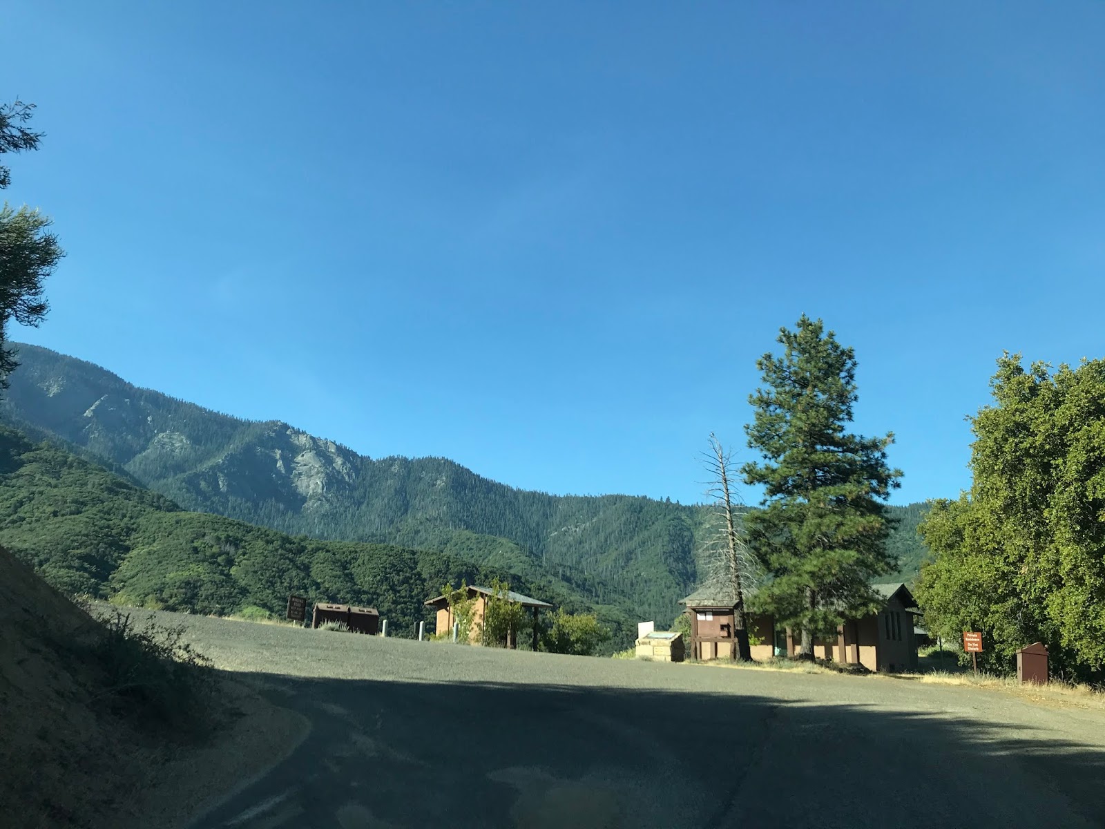
Mineral King Road passes through a third dirt segment and emerges into Mineral King Valley. Mineral King Road crosses the wooden bridge on the East Fork Kaweah River and terminates at the Eagle-Mosquito Trailhead.


Part 4; the climb to the White Chief Mine
The climb to the White Chief Mine begins at the Eagle-Mosquito Trailhead at 7,830 feet above sea level in Mineral King Valley. The split with the White Chief Mine Trail is located at a junction one mile south of the Eagle-Mosquito Trailhead.


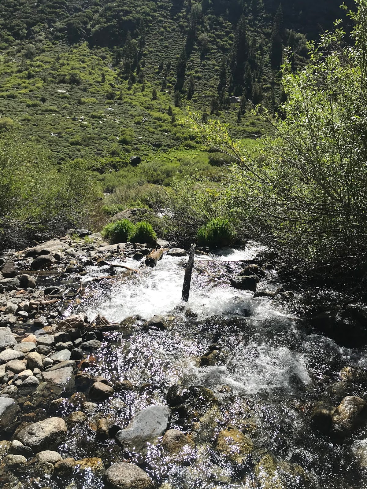
The Eagle-Mosquito Trail starts out in Mineral King Valley along south bank of the East Fork Kaweah River. The Eagle-Mosquito Trail quickly crosses the Eagle Creek and begins to ascend. Note; the East Fork Kaweah River turns south towards it's headwaters in Mineral King Valley.


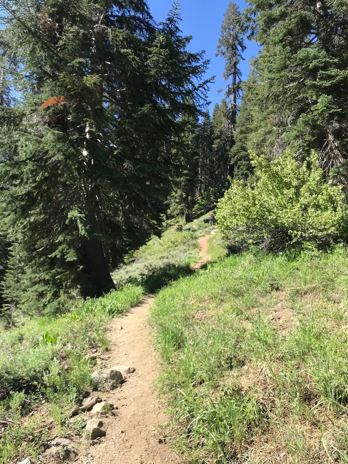
The Eagle-Mosquito Trail begins a steep uphill climb towards the junction with the White Chief Mine Trailhead. Across Mineral King Valley the falls of Crystal Creek can be seen.


The Eagle-Mosquito Trail reaches the White Chief Mine Trail about one mile south of the end of Mineral King Road. The White Chief Mine/White Chief Canyon is signed as 1.8 miles due south on the White Chief Mine Trail.


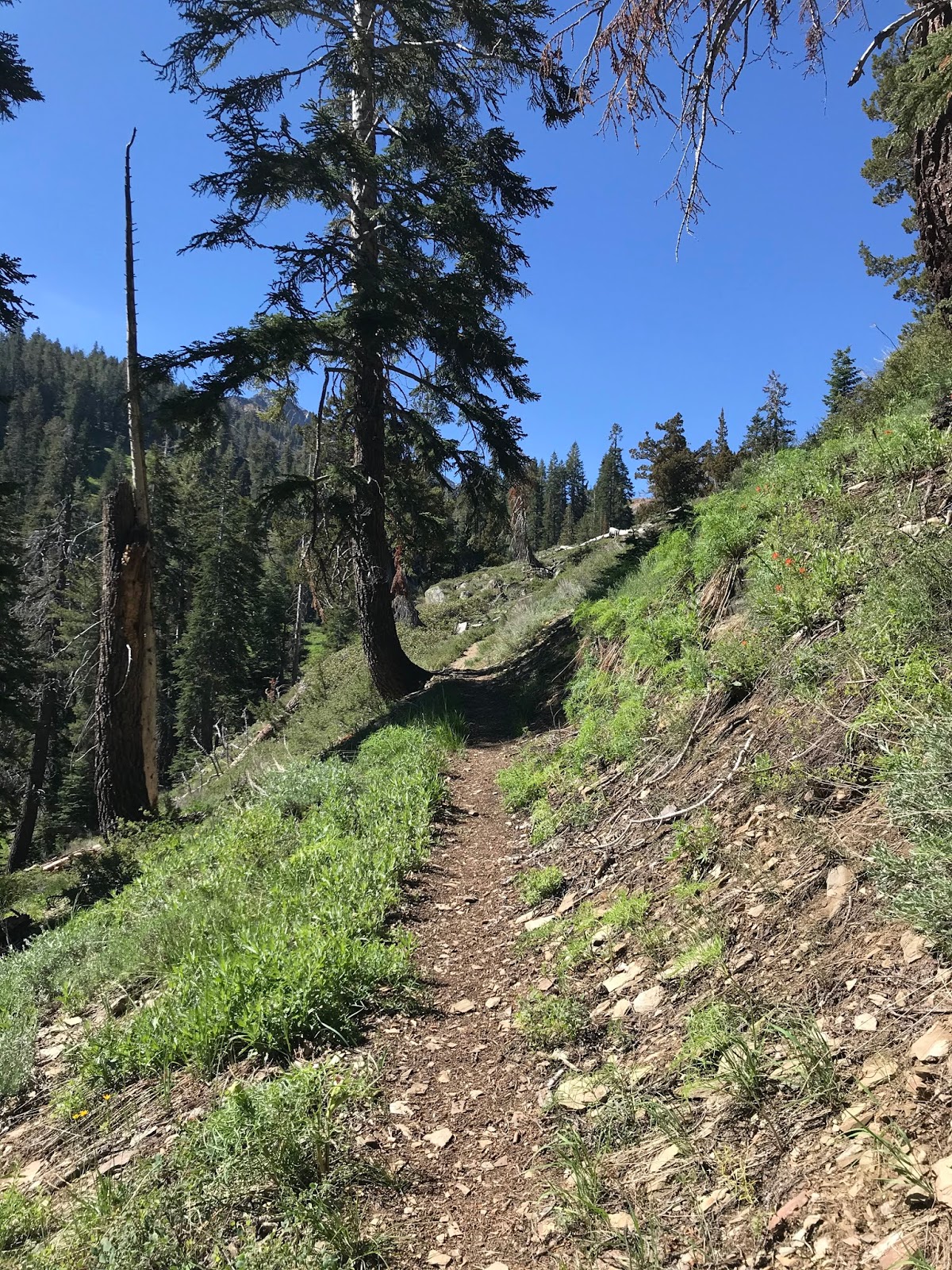
The White Chief Mine Trail is very steep but well maintained. The White Chief Mine Trail follows the East Fork Kaweah River to a bluff where the trail flattens out.


Looking back north into Mineral King Valley reveals a view of the 12,348 foot high Sawtooth Peak.

The White Chief Mine Trail follows a gap along the East Fork Kaweah River into White Chief Canyon.


White Chief Canyon bears the scars of mining activity as there is tree fall and overburden strewn over the floor of White Chief Canyon. The White Chief Mine Trail ends at the headwaters of the East Fork Kaweah River which are located at a small waterfall at the White Chief Bowl formation. The White Chief Mine is located at 9,445 feet above sea level. Upon reaching the White Chief Bowl I turned around to head back towards Mineral King Valley and the drive back to Three Rivers on Mineral King Road. It is hard to fathom White Chief Valley being a center of mining activity during the 1870s given how devoid of human life it is now.


Comments
Do you have any information on the aqueduct that runs along Mineral King Road?
https://drive.google.com/file/d/1acult4Z-NLCUXP7Hmn-JwWsFlVvGlDpo/view?usp=sharing