After landing in Tampa my path out of the city was north on a road I've driven many times; Florida State Road 589. FL 589 is a 55 mile north/south toll road between FL 60 in the city of Tampa in Hillsborough County north to US Route 98 in Hernando County. The 13 miles north of FL 60 are designated as the Veterans Expressway. From Tampa International Airport the ramp designs are a little odd and can lead drivers to getting onto another road easily.


At the junction of FL 580 the first true Veterans Expressway shield northbound appears. Since 2014 the Veterans Expressway portion of FL 589 has been cashless tolls. The Veterans Expressway was infamous for long back ups at toll booths southbound during rush hour and led to some hectic airport drives when I was living in Florida.

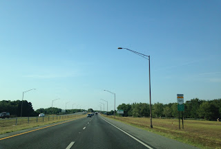
I always really liked the signage in Florida, a lot of money obviously goes into up keep of sign assemblies.

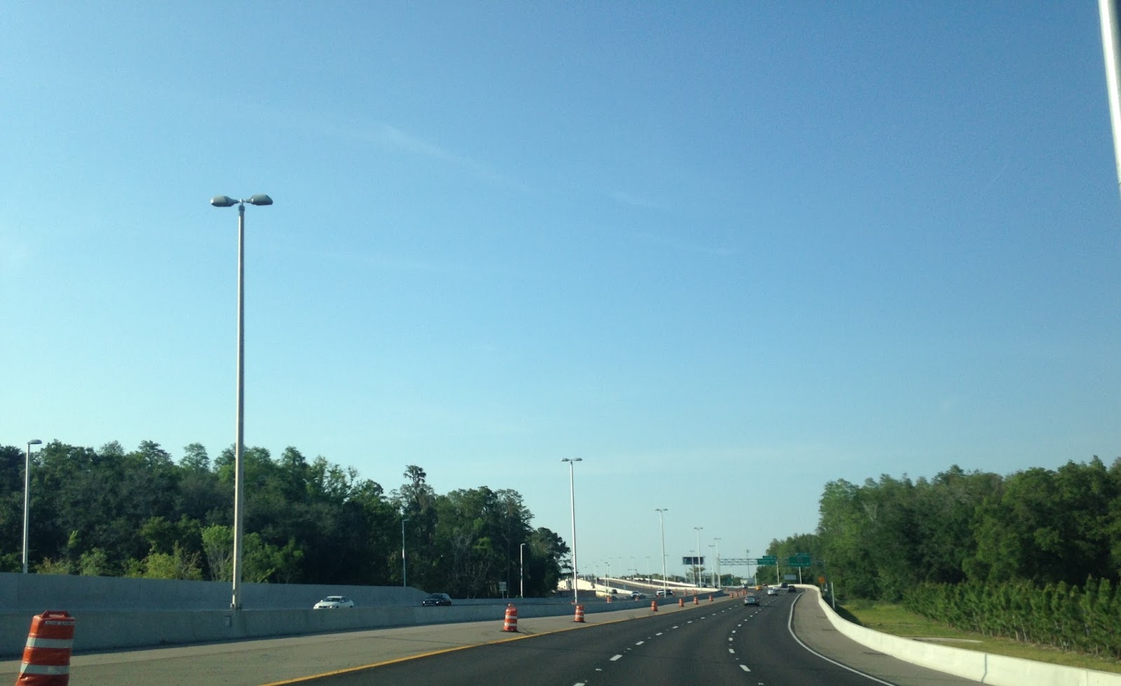
The next significant junction is County Route 584/Waters Avenue. My understanding is that the coned areas were intended for construction of express lanes.


CR 587/Gunn Highway is at exit 9.

A little call-back to how awful the Veterans Expressway really used to be. It felt weird to see electronic tolling in places of a toll plaza.

Exit 13 takes traffic towards FL 597/Dale Mabry Highway while exit 14 goes to CR 685A/Van Dyke Road.


Exit 13 is actually part of the former alignment of the Veterans Expressway known as FL 568. When the Veterans Expressway was completed in 1994 it utilized FL 568 and ended at FL 597. When the Suncoast Parkway section of FL 589 was completed in 2001 it led to FL 568 being created out of a former section of the Veterans Expressway. The Suncoast Parkway portion of FL 589 begins north of exit 13.
Exit 16 junctions CR 582 Lutz Lake Fern Road.

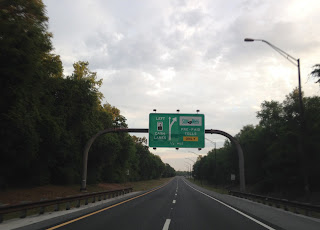
Another cool guide sign.

FL 589 north enters Pasco County and junctions FL 54 at exit 19.

Back when I first encountered the Suncoast Parkway I believe the Sunpass bypasses just had been built. Nowadays there is still a manned toll booth but it isn't meant for the primary flow of traffic.


At exit 27 the Suncoast Parkway junctions FL 52. Fun fact; FL 52's alignment used to carry US 19 when it was first routed into Florida. The alignment shifts on US 19 in the Spring Hill area are massive, I'll probably dedicate a blog to it at some point.

One more big toll plaza bypass before exit 37 for CR 578/County Line Road in Hernando County.


Exit 41 junctions CR 574/Spring Hill Drive.

Exit 46 is for FL 50 which is one of the major State Roads in Florida. If you can't tell already, Florida uses a grid similar to the US Route system with State Road numbers. X0 State Roads are considered the major east/west highways.

There is one more toll plaza northbound before US 98.
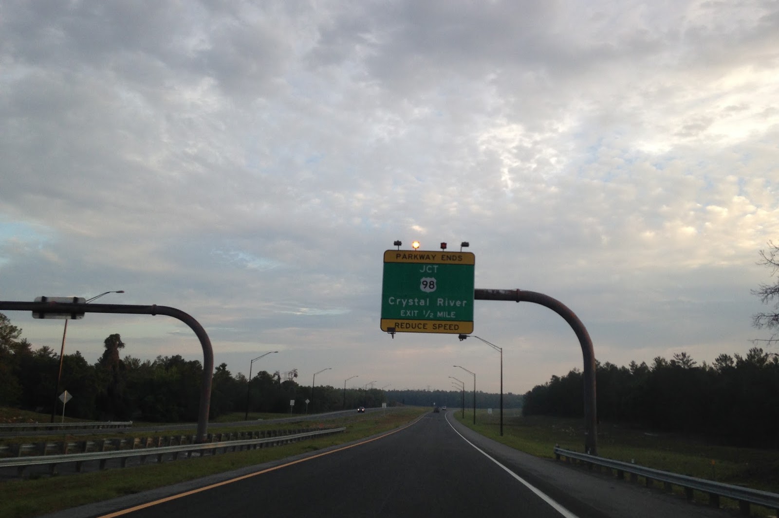
The Suncoast Parkway/FL 589 ends at US 98 just south of the Citrus County Line.


There has been talk about plans to extend the Suncoast Parkway either into Citrus County within vicinity of FL 44 and even more far-flung talks like Jacksonville via the US 301 corridor. FL 589 essentially is what made suburban living north of Tampa as far as FL 50/Brooksville somewhat practical. Most of FL 589 is signed as 70 MPH and doesn't have much traffic southbound until FL 54. Having a road does further into Citrus County is somewhat practical in my opinion but the US 301 corridor ought to be addresses in another way.


At the junction of FL 580 the first true Veterans Expressway shield northbound appears. Since 2014 the Veterans Expressway portion of FL 589 has been cashless tolls. The Veterans Expressway was infamous for long back ups at toll booths southbound during rush hour and led to some hectic airport drives when I was living in Florida.

I always really liked the signage in Florida, a lot of money obviously goes into up keep of sign assemblies.

The next significant junction is County Route 584/Waters Avenue. My understanding is that the coned areas were intended for construction of express lanes.

CR 587/Gunn Highway is at exit 9.

A little call-back to how awful the Veterans Expressway really used to be. It felt weird to see electronic tolling in places of a toll plaza.

Exit 13 takes traffic towards FL 597/Dale Mabry Highway while exit 14 goes to CR 685A/Van Dyke Road.


Exit 13 is actually part of the former alignment of the Veterans Expressway known as FL 568. When the Veterans Expressway was completed in 1994 it utilized FL 568 and ended at FL 597. When the Suncoast Parkway section of FL 589 was completed in 2001 it led to FL 568 being created out of a former section of the Veterans Expressway. The Suncoast Parkway portion of FL 589 begins north of exit 13.

Exit 16 junctions CR 582 Lutz Lake Fern Road.

Another cool guide sign.

FL 589 north enters Pasco County and junctions FL 54 at exit 19.

Back when I first encountered the Suncoast Parkway I believe the Sunpass bypasses just had been built. Nowadays there is still a manned toll booth but it isn't meant for the primary flow of traffic.


At exit 27 the Suncoast Parkway junctions FL 52. Fun fact; FL 52's alignment used to carry US 19 when it was first routed into Florida. The alignment shifts on US 19 in the Spring Hill area are massive, I'll probably dedicate a blog to it at some point.

One more big toll plaza bypass before exit 37 for CR 578/County Line Road in Hernando County.


Exit 41 junctions CR 574/Spring Hill Drive.

Exit 46 is for FL 50 which is one of the major State Roads in Florida. If you can't tell already, Florida uses a grid similar to the US Route system with State Road numbers. X0 State Roads are considered the major east/west highways.

There is one more toll plaza northbound before US 98.

The Suncoast Parkway/FL 589 ends at US 98 just south of the Citrus County Line.


There has been talk about plans to extend the Suncoast Parkway either into Citrus County within vicinity of FL 44 and even more far-flung talks like Jacksonville via the US 301 corridor. FL 589 essentially is what made suburban living north of Tampa as far as FL 50/Brooksville somewhat practical. Most of FL 589 is signed as 70 MPH and doesn't have much traffic southbound until FL 54. Having a road does further into Citrus County is somewhat practical in my opinion but the US 301 corridor ought to be addresses in another way.
Comments