
California State Route 152 is a 105 mile State Highway which begins at California State Route 1 in Watsonville. CA 152 travels east over the Diablo Range via Pacheco Pass to San Joaquin Valley where it terminates at California State Route 99 near Chowchilla.

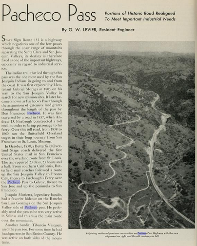
Part 1; the history of California State Route 152
The history of California State Route 152 ("CA 152") is largely tied to that of Pacheco Pass in the Diablo Range. An established trail over Pacheco Pass had been use by the local Yokut Tribes long before the arrival of Europeans to California. The first documented European crossing of Pacheco Pass was made in 1805 by a party led by Spanish Army Officer Gabriel Moraga. Pacheco Pass became a well-established route of travel used by the Spanish, Mexicans and even local drives through the early 19th Century. Between 1833 and 1836 Ranchero Francisco Perez Pacheco was granted land that would comprise Rancho Ausaymas y San Felipe. Rancho Ausaymas y San Felipe was plotted over land which included what is now Pacheco Pass. Francisco Perez Pacheco eventually became the namesake of what is now known as Pacheco Pass.
During the American period Andrew Firebaugh constructed a tolled stage road across Pacheco Pass to Bell Station. Firebaugh's toll road was completed by 1857 and was part of the Butterfield Overland Mail route between 1858-1861. A primitive path over Pacheco Pass to Gilroy can be seen on the 1857 Britton & Rey's Map of California.

The Butterfield Overland route over Pacheco Pass is touched on in the September 1950 California Highways & Public Works.


The more established Pacheco Pass Toll Road can be seen on the 1873 Bancroft's Map of California. In 1879 Santa Clara County and Merced County purchased the Pacheco Pass Toll Road, rebuilt it on a new grade and made it a public highway.

The history of State Highways over Pacheco Pass begins in 1915 with the passage of the Second State Highway Bond Act. Legislative Route Number 32 ("LRN 32") was added to the State Highway System with the following definition:
"an extension connecting the San Joaquin valley trunk line (LRN 4/Inland Route) at a point between the city of Merced in Merced County and the city of Madera in Madera County with the coast trunk line (LRN 2/Pacific Highway) at or near the city of Gilroy in Santa Clara County, through Pacheco Pass, by the most direct and practical route."
The entirety of LRN 32 between Califa and Gilroy by way of Pacheco Pass appears on the 1917 California State Automobile Map.

According to the March/April 1951 California Highways & Public Works the State completed construction of a new alignment for LRN 32 over Pacheco Pass by 1923. The 1923 alignment of LRN 32 was a replacement for the 1879 Santa Clara County/Merced County highway.


The September 1929 California Highways & Public Works
expounds more on the Berenda-Califa realignment of US 99/LRN 4. The
new alignment of US 99/LRN 4 is described to include a rail subway on US
99/LRN 4 in Califa which was slated to be constructed by the Southern
Pacific Railroad.

The realignment of US 99/LRN 4 along with the Southern Pacific Railroad Subway are described as being complete in the April 1930 California Highways & Public Works.

In 1933 LRN 32 would be extended west from Gilroy via Hecker Pass to Watsonville. The entirety of LRN 32 was announced as CA 152 in the August 1934 California Highways & Public Works.


The initial alignment of CA 152 on LRN 32 can be seen on the 1935 Division of Highways Maps:
- Madera County; Califa at US 99/LRN 4 west to the Merced County Line.

- Merced County; Madera County line west to Pacheco Pass and the Santa Clara County Line.


- Santa Clara County; from Pacheco Pass to the Santa Cruz County Line via Gilroy and Hecker Pass.

- Santa Cruz County; from the Santa Clara County Line to Watsonville.

The March/April 1951 California Highways & Public Works details the realignment of CA 152 from Bell Station east to the Merced County Line. The older alignment of CA 152 is shown in comparison to the new expressway segment.


The Chowchilla Freeway upgrade of US 99 is discussed in the March/April 1957 California Highways & Public Works. The Chowchilla Freeway is described as being aligned east of Chowchilla Boulevard on a new bypass route for US 99/LRN 4. The 1930 Southern Pacific Railroad subway is discussed as being converted from two-way traffic to use exclusively for northbound US 99 traffic. The US 99/CA 152 junction upgrade is described as being converted from being at-grade to a series of ramps. Work on the Chowchilla Freeway is described as having broken ground on March 23rd, 1956, with an anticipated completion coming in July 1957.


The realignment of CA 152 north of the planned San Luis Reservoir is discussed in the July/August 1965 California Highways & Public Works. The realignment of CA 152 is cited to be 12 miles in length originating from the Merced/Santa Clara County Line and extending eastward as a divided road to CA 207. CA 152 was relocated as its previous alignment originating at Pacheco Pass was to be inundated by the San Luis Reservoir. The new expressway alignment of CA 152 had a dedication ceremony on April 29th, 1965. The San Luis Reservoir would not be completed until 1967.


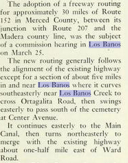
The November/December 1966 California Highways & Public Works announced the construction of CA 152 from Ward Road in Los Banos to the Madera County Line as an expressway was funded for the 1967-68 Fiscal Year.

The CA 1 bypass of Watsonville was completed in the late 1960s and first appears on the 1969 Division of Highways Map. The CA 1 bypass of Watsonville extended CA 152 west of downtown via Main Street to retain connectivity with CA 1.

The 1969 Division of Highways Map also shows CA 152 built to expressway standards to east of Pacheco Pass to Los Banos. CA 152 from the Madera County Line east to CA 99 is shown upgraded to expressway standards as well.

The 1970 Division of Highways State Map shows CA 152 built to expressway standards east of Los Banos to the Madera County Line. The bypass of Los Banos was ultimately never constructed.

US 101 was completed to freeway standards in Gilroy by 1972. This in turned moved US 101 off of Monterey Street onto the modern freeway bypass (known as the Valley Freeway). CA 152 originally entered Gilroy via Old Gilroy Road westbound and multiplexed US 101 to 1st Street. CA 152 was shifted onto the new freeway between Exit 356/10th Street and Exit 357/Leavesley Road. CA 152 followed Leavesley Road west to Monterey Street where it jogged south to reach 1st Street. The 1975 Caltrans State Map displays the then new alignments of US 101 and CA 152 in Gilroy.

In 1992 CA 152 west of Bell Station to the CA 152/CA 156 Y-Intersection was upgraded to four lanes. The previous alignment of CA 152 became Casa de Fruita Parkway. In 2010 the Joseph A. Zanger Memorial Flyover was completed and created a grade separation at the CA 152/CA 156 intersection.
Part 2; a drive on California State Route 152
CA 152 westbound from CA 99 northbound begins from a left hand exit near Chowchilla in Madera County.


CA 152 west of CA 99 is signed as the William Whitehurst Memorial Highway.

At Postmile MAD 11.1 CA 152 west intersects CA 233/Robertson Boulevard.

CA 152 westbound crosses the Merced County Line approaching a junction with CA 59. West of CA 59 the route of CA 152 is signed as 20 miles from Los Banos.


At Postmile MER R37.20 CA 152 west crosses the San Joaquin River.

At approximately Postmile MER R32.37 CA 152 westbound picks up CA 33 northbound.


Upon entering the City of Los Banos CA 152 west/CA 33 north drops to a normal undivided highway on Pacheco Boulevard. At approximately Postmile MER 21.28 CA 152 west/CA 33 north intersects CA 165 at Mercy Springs Road.


CA 152 west/CA 33 north departing Los Banos resumes an expressway grade and is signed as 5 miles from I-5.


At Postmile MER 14.25 CA 152 west/CA 33 crosses the California Aqueduct and approaches a junction with I-5.

CA 152/CA 33 west of I-5 is signed as 7 miles from the San Luis Reservoir.


CA 33 north splits from CA 152 west at approximately Postmile MER 11.28.

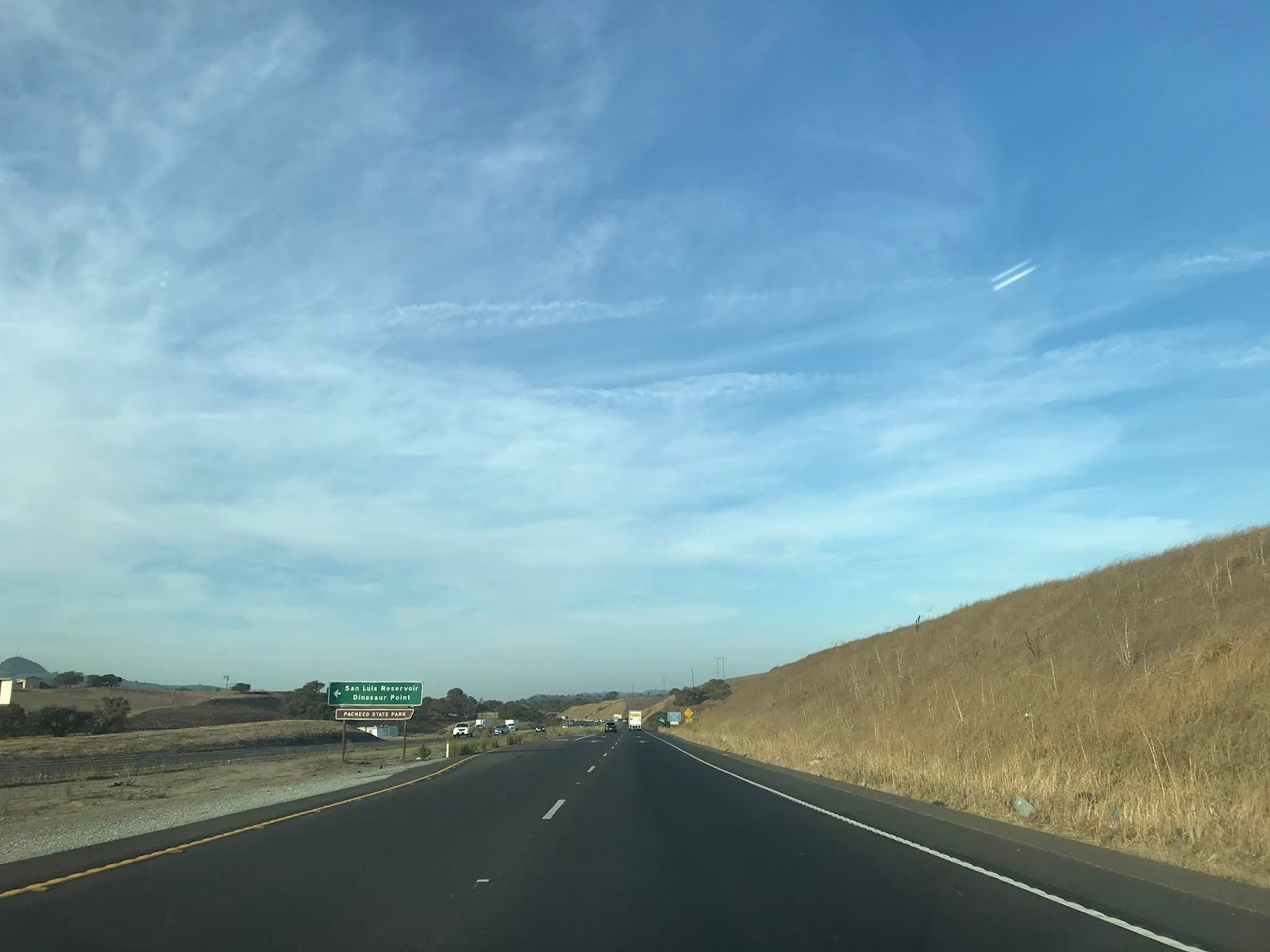
CA 152 west approaches the San Luis Reservoir and passes by O'Neill Forebay. CA 152 west is signed with an Elk advisory 13 miles in length.


At approximately Postmile MER R10.15 CA 152 west passes by the spillway for the San Luis Dam.

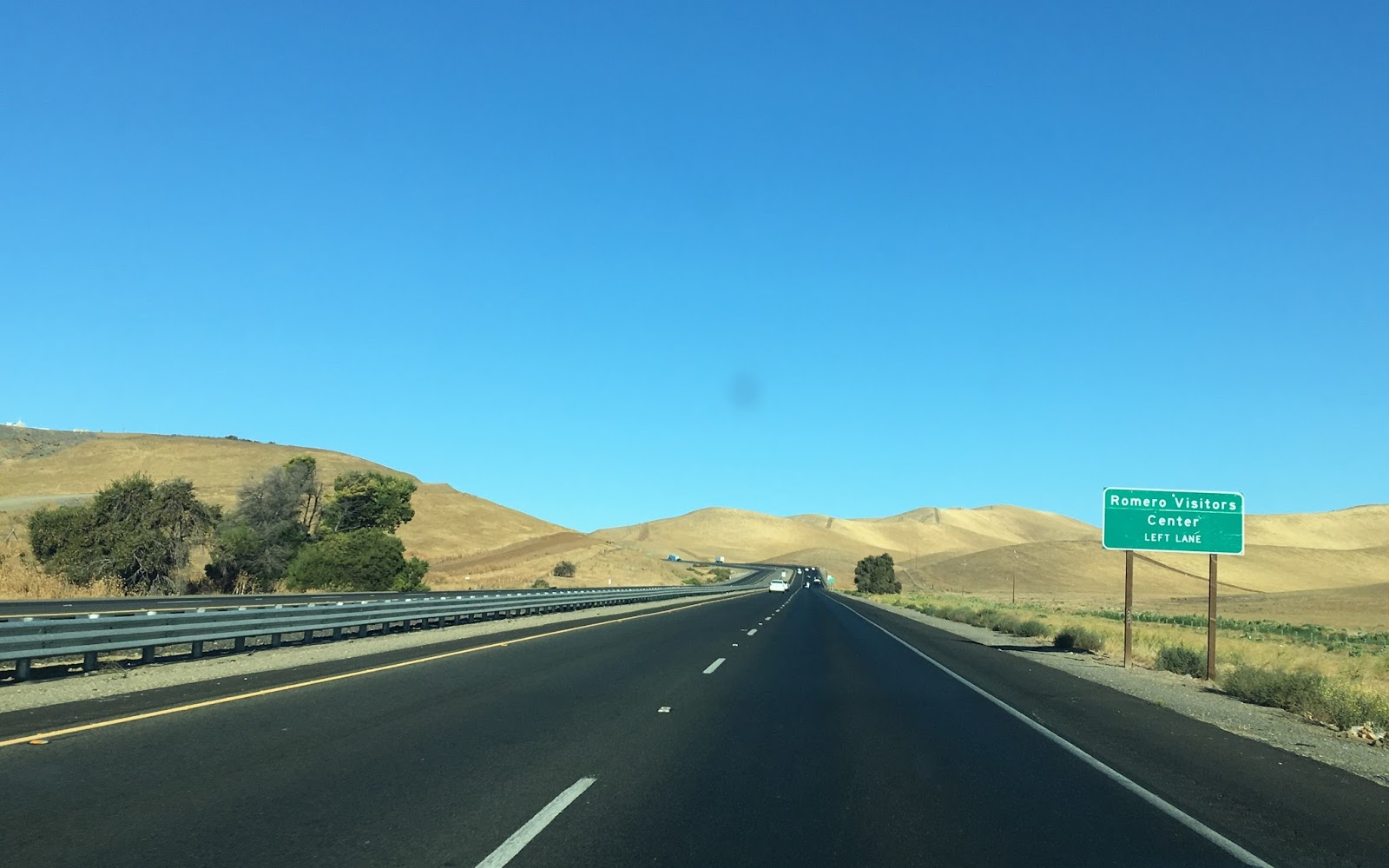
At Postmile MER R8.00 CA 152 intersects a turnoff for the Romero Visitor which overlooks the San Luis Reservoir.


The climb on CA 152 westbound to Pacheco Pass includes a third climbing lane for trucks. Despite relatively steep grade the summit of Pacheco Pass is only 1,368 feet above sea level at Dinosaur Point Road (the original alignment of CA 152). Pacheco Pass serves as the Santa Clara County Line.


For contrast this is how the climb to Pacheco Pass on CA 152 west looks with a full San Luis Reservoir.

CA 152 west steeply descends from Pacheco Pass following the course of Pacheco Creek. CA 152 west intersects Bell Station at Kaiser-Aetna/Postmile SCL R28.85. At Postmile SCL R23.42 CA 152 west intersects Casa de Fruita Parkway.


Another contrast; this is how CA 152 west appears following a very wet winter near Casa de Fruita:

CA 152 west intersects CA 156 at the Zanger Flyover at approximately Postmile R22.00.

CA 152 west of CA 156 is signed as 11 miles from Gilroy.

CA 152 drops to a two lane highway and a Safety Corridor. CA 152 west intersects Santa County Route G7 at Bloomfield Avenue/Postmile SCL 14.88.

At Postmile SCL 12.81 CA 152 west intersects Santa Clara County Route G9. Note; the CA 152/G9 intersection has been upgraded to a roundabout since this blog was originally published.

CA 152 west enters the City of Gilroy merges onto a multiplex of US 101 northbound on the Valley Freeway at approximately Postmile SCL R10.00.


CA 152 west follows US 101 north to Exit 357 and splits away at Santa Clara County Route G8/Leavesley Road.


CA 152 jogs westward on Leavesley Road, crosses the Union Pacific Railroad and turns south onto Monterey Road at Postmile SCL M9.77.


CA 152 turns west towards Hecker Pass at 1st Street/Postmile SCL 9.42.


Hecker Pass lies at an elevation of1,309 feet above sea level in the Santa Cruz Mountains and serves as the Santa Cruz County Line. The Mount Madonna Inn has a nice overlooks of Watsonville. and the ocean below.


CA 152 westbound descends from Hecker Pass and follows Lake Avenue into Watsonville.


At Postmile SCR T3.271L CA 152 west splits into a one-way coupling. CA 152 west continues on Lake Avenue to Main Street whereas CA 152 eastbound utilizies; Main Street, Beach Street and Lincoln Street.


CA 152 west follows Main Street out of downtown Watsonville to a terminus at CA 1.


Update History
- Originally Published; 10/4/17
- Update 1; 2/3/21
Comments