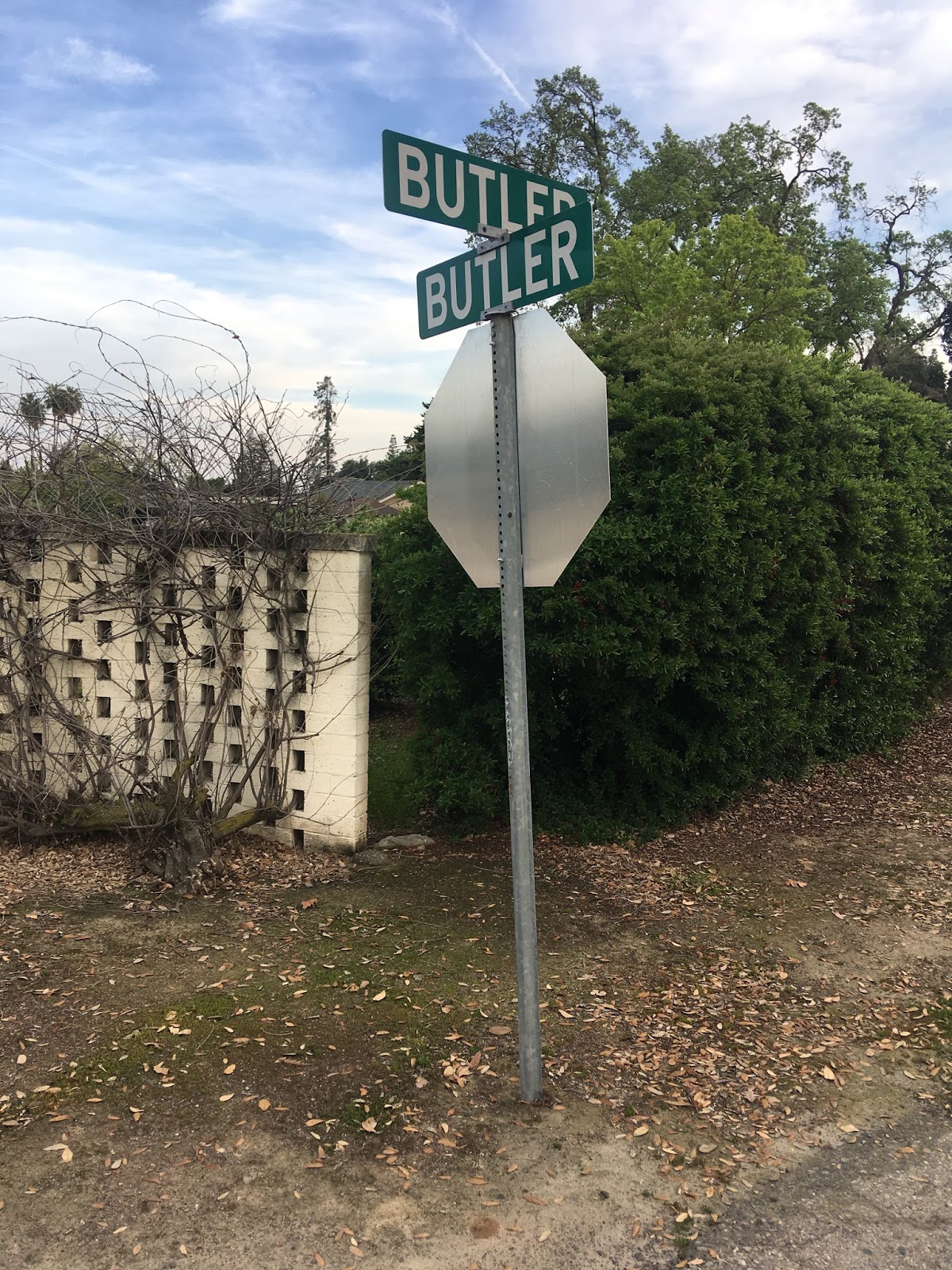
Near the far flung eastern expanses of the city of Fresno in a County Island there is a roadside oddity along Butler Avenue. Just west of the junction with Fowler Avenue there is a cross-street signed as Butler/Butler.

If you are a Seinfeld fan you'd might consider a junction where a street intersects with itself to be the "nexus of the universe." Howsoever it appears the Butler/Butler street blade signage is simply the result of Fresno County not often signing; street, place, lane, road, drive, or boulevard for whatever reason. However, the location of Butler/Butler is approximately located a half mile north of the Butler ghost town site. Butler was located on the Southern Pacific Railroad line heading east out of downtown Fresno towards Sanger.

Butler was a rail siding town along the Stockton and Tulare Railroad which was apparently built likely in 1887. The first map reference to Butler I can find is on the 1889 map of the State of California.
1889 Map of California
Butler appears to have been a sizeable settlement as evidenced by this sectional of a large Fresno County Map below from 1891.
1891 Fresno County Sectional Map
Interestingly Butler appears to have been located at the junction of what is now Fowler Avenue and a street called Malvoise Avenue. Malvoise Avenue used to run on the north side of the Stockton and Tulare Railroad tracks. A portion of Malvoise Avenue appears to still exist today as a rail service road west of Clovis Avenue. Bulter appears to have had an organized street grid that appears to have been completely lost to time. Muscatel Avenue is the modern alignment of Butler Avenue but I have no idea when the name may have changed.
The last map reference I can find for Bulter was on the 1935 California Division of Highways Fresno County map. Additional sidings east of Butler can be seen and were called; Locans, Ivesta, and Clotho.
1935 Fresno County Highway Map
Comments