Back in 2012 I visited the Gillespie Dam Bridge located southwest of Phoenix in rural Maricopa County along the Gila River.

The Gillespie Dam Bridge is a truss bridge located directly south of the failed 1921 Gillespie Dam on the Gila River. The Gillespie Dam Bridge was completed in August of 1927 and was part of early US Route 80. The Gillespie Dam Bridge is 1,662 feet long, has a road deck 25 feet wide, has 9 spans, and 8 pilings in the Gila River Bed. The Gillespie Dam Bridge saw service on US Route 80 until the highway was shifted eastward in 1956 to the current Arizona State Route 85 corridor.
The Gillespie Dam Bridge actually survived a breach of it's namesake dam. The Gillespie Dam is a 1,700 foot wide concrete arch structure which was completed in 1921 as stated above. The Gillespie Dam was originally designed for cars to travel over, but with the spill-over design it meant that it couldn't be crossed when the reservoir topped out. The Gillespie Dam was part of the original alignment of US Route 80 but only for a brief period of time. In 1993 record winter flooding on the Salt River and Gila River caused a 120 foot section of the Gillespie Dam to fail which can be seen from the Gillespie Dam Bridge.


The Gillespie Dam replaced the earlier Auto Trail span located northeast of Wellton in Yuma County which was called the Antelope Hill Bridge. The Antelope Hill Bridge was a wooden structure that was completed in 1915 over the Gila River. The Antelope Hill Bridge carried the; Old Spanish Trail, Dixie Overland Trail, Southern National Highway, and Bankhead Highway over the Gila River from 1914 until the Gillespie Dam replaced it in 1921. The original route from Yuma to Phoenix went through the communities of; Dome, Wellton (over to the north bank of the Gila River on the Antelope Hill Bridge), Palomas, Aqua Caliente, Arlington, and Buckeye. The new route (which eventually became US 80) over the Gila River at the Gillespie Dam ultimately diverged in Wellton continuing on the south bank through the communities of; Stoval, Sentinel, and Gila Bend. This 1924 Four Corners Area Auto Trail Maps shows both the Antelope Hill Route and Gillespie Dam Route over the Gila River.
Four Corners Auto Trail Map
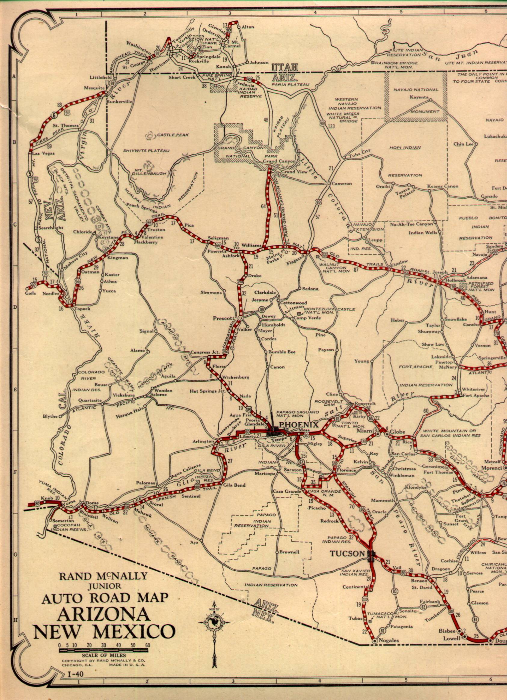
This 1927 highway map of Arizona shows the original routing of US 80. It is unclear if the alignment if over the Gillespie Dam or Gillespie Dam Bridge.
1927 Arizona State Highway Map
This 1956 Arizona State Highway Map shows the shift of US 80 east to the AZ 85 corridor.
1956 Arizona State Highway Map

The Gillespie Dam Bridge is a truss bridge located directly south of the failed 1921 Gillespie Dam on the Gila River. The Gillespie Dam Bridge was completed in August of 1927 and was part of early US Route 80. The Gillespie Dam Bridge is 1,662 feet long, has a road deck 25 feet wide, has 9 spans, and 8 pilings in the Gila River Bed. The Gillespie Dam Bridge saw service on US Route 80 until the highway was shifted eastward in 1956 to the current Arizona State Route 85 corridor.
The Gillespie Dam Bridge actually survived a breach of it's namesake dam. The Gillespie Dam is a 1,700 foot wide concrete arch structure which was completed in 1921 as stated above. The Gillespie Dam was originally designed for cars to travel over, but with the spill-over design it meant that it couldn't be crossed when the reservoir topped out. The Gillespie Dam was part of the original alignment of US Route 80 but only for a brief period of time. In 1993 record winter flooding on the Salt River and Gila River caused a 120 foot section of the Gillespie Dam to fail which can be seen from the Gillespie Dam Bridge.


The Gillespie Dam replaced the earlier Auto Trail span located northeast of Wellton in Yuma County which was called the Antelope Hill Bridge. The Antelope Hill Bridge was a wooden structure that was completed in 1915 over the Gila River. The Antelope Hill Bridge carried the; Old Spanish Trail, Dixie Overland Trail, Southern National Highway, and Bankhead Highway over the Gila River from 1914 until the Gillespie Dam replaced it in 1921. The original route from Yuma to Phoenix went through the communities of; Dome, Wellton (over to the north bank of the Gila River on the Antelope Hill Bridge), Palomas, Aqua Caliente, Arlington, and Buckeye. The new route (which eventually became US 80) over the Gila River at the Gillespie Dam ultimately diverged in Wellton continuing on the south bank through the communities of; Stoval, Sentinel, and Gila Bend. This 1924 Four Corners Area Auto Trail Maps shows both the Antelope Hill Route and Gillespie Dam Route over the Gila River.
Four Corners Auto Trail Map
This 1927 highway map of Arizona shows the original routing of US 80. It is unclear if the alignment if over the Gillespie Dam or Gillespie Dam Bridge.
1927 Arizona State Highway Map
This 1956 Arizona State Highway Map shows the shift of US 80 east to the AZ 85 corridor.
1956 Arizona State Highway Map
Comments