A visit to the Abandoned Pennsylvania Turnpike - October 2004

In October 2004, Pennsylvania Highways webmaster and friend of the blog, Jeff Kitsko, hosted a road meet centered on the abandoned Pennsylvania Turnpike in Breezewood.  I was fortunate to attend.  What is unique about this trip to the abandoned highway is that we actually were able to drive on the old turnpike 36 years after it was bypassed.  We also were able to walk into the offices and ventilation areas of the tunnels for a unique perspective of the old highway.  Co-blogger Doug Kerr also was at the meet and some of his photos are included below.

From the start of our trip in Breezewood and looking back towards the Breezewood Interchange and the start of the abandoned Turnpike.  (Doug Kerr)
Entrance to the western portal of Ray's Hill Tunnel.  At a length of only 2,532 feet, only one set of exhaust fans - at the eastern portal - was needed.
After exiting the tunnel, autumn traveling motorists journeyed through a chute of color towards the Sideling Hill Tunnel, then the longest in the system.
Near the western portal of Sideling Hill is this stone culvert built for the South Penn Railroad.
A look inside the Sideling Hill Tunnel.  You can see why many bikers and walkers decide to turn around and not make it to the other side. (Doug Kerr)
A view from the upstairs offices located inside the western portal of the Sideling Hill Tunnel.  The cars give a great demonstration of how two lanes of Turnpike traffic would merge into one entering the tunnel.
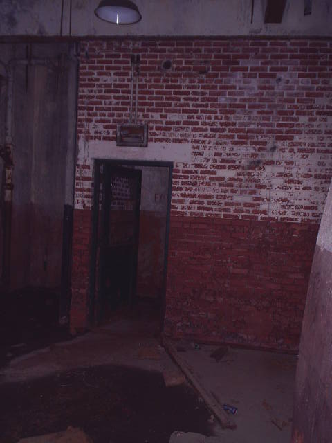
Inside the Sideling Hill Tunnel and doorway leading to upstairs. (Doug Kerr)
Graffiti is rampant inside the tunnel.  (Doug Kerr)
Looking back towards the eastern portal of Sideling Hill Tunnel, which is over 6700 feet long!
A look at the abandoned pike from near the site of the former Cove Valley Travel Plaza.

Site Navigation:
Sources & Links:

Comments

Warren Taylor said…
I'm also visiting this site regularly, this web site is really nice and the users are genuinely sharing good thoughts.

Popular posts from this blog

The 1915-era Teilman Bridge (the only known Concrete Pony Truss Bridge in California)

The Teilman Bridge is a semi-abandoned structure over Fresno Slough west of Burrell siding near the intersection of Elkhorn Avenue and Elkhorn Grade.  This structure is the only known Concrete Pony Truss Bridge constructed in California and was designed by Ingvart Teilman.  Teilman's Bridge would open in late 1915 when the Elkhorn Grade was the primary road between Fresno and Coalinga.  The structure would be replaced in 1991 but was left standing as it carries pipelines over Fresno Slough.  Part 1; the history of the Teilman Bridge In the early Twentieth Century the most direct highway between Fresno and Coalinga followed the Elkhorn Grade.  The Elkhorn Grade began at Fresno Slough a short distance west of Burrell siding.  From Fresno Slough the Elkhorn Grade followed a generally southwestern course through San Joaquin Valley into the Kettleman Hills towards Coalinga.   The Elkhorn Grade can be seen on the  1914 C.F. Weber map of Fresno Coun...

Former California State Route 41 past Bates Station

When California State Route 41 was commissioned during August 1934 it was aligned along the then existing Fresno-Yosemite Road north of the San Joaquin River.  Within the Sierra Nevada foothills of Madera County, the original highway alignment ran past Bates Station via what is now Madera County Road 209, part of eastern Road 406 and Road 207.   Bates Station was a stage station plotted during the early 1880s at what was the intersection of the Coarsegold Road and Stockton-Los Angeles Road.   The modern alignment bypassing Bates Station to the east would be reopened to traffic during late 1939.   Part 1; the history of California State Route 41 past Bates Station Bates Station was featured as one of the many 1875-1899 Madera County era towns in the May 21, 1968, Madera Tribune .  Post Office Service at Bates Station is noted to have been established on November 23, 1883 and ran continuously until October 31, 1903.  The postal name was sourced...

The William Flinn (not Flynn) Highway - Pittsburgh's Misspelled Street

For decades if you traveled along PA Route 8 in Pittsburgh's North Hills suburbs, you would have noticed signs that read "William Flynn Highway" at every intersection.  Even today, many businesses and residences have their addresses listed as XXXX William Flynn Highway.  However, it's not William Flynn Highway, it is William FLINN Highway - and the gentleman who it is named for has a long and storied past in Pittsburgh's infrastructure history. William Flinn was born in England in 1851; however later that year, his family emigrated to the United States and would settle in Pittsburgh.  A 10-year-old school dropout, Flinn grew interested in politics and would join the Allegheny County Republican Party in 1877 as a ward commissioner and a seat on the Board of Fire Commissioners.  Flinn would serve in the Pennsylvania State House of Representatives and Senate from 1877 to 1902. (1) Flinn along with James J. Booth would found the Booth and Flinn construction firm ...